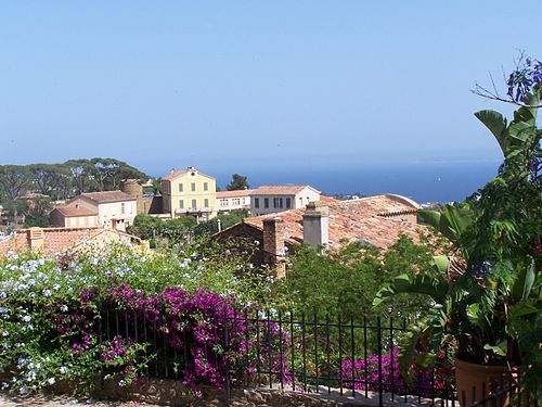
Le Lavandou, a small village on the Var coast
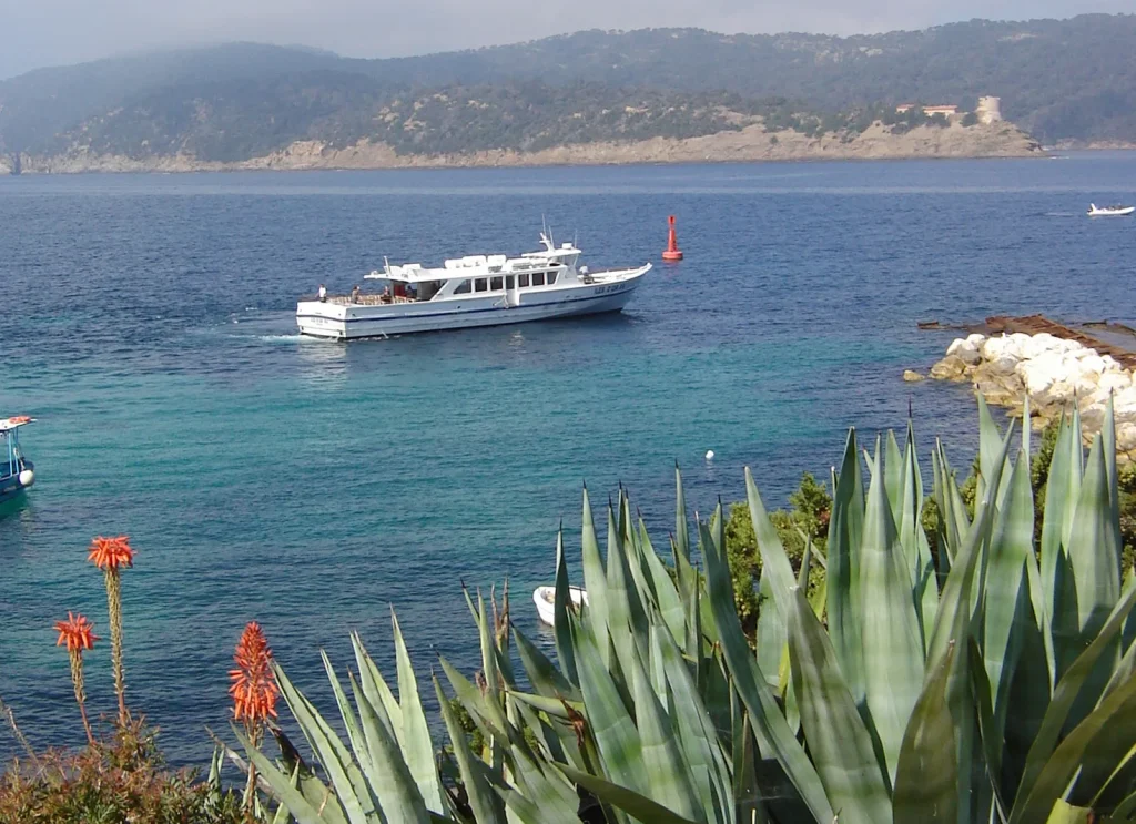
facing the Îles du Levant, Port Cros and Porquerolles.


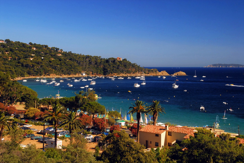
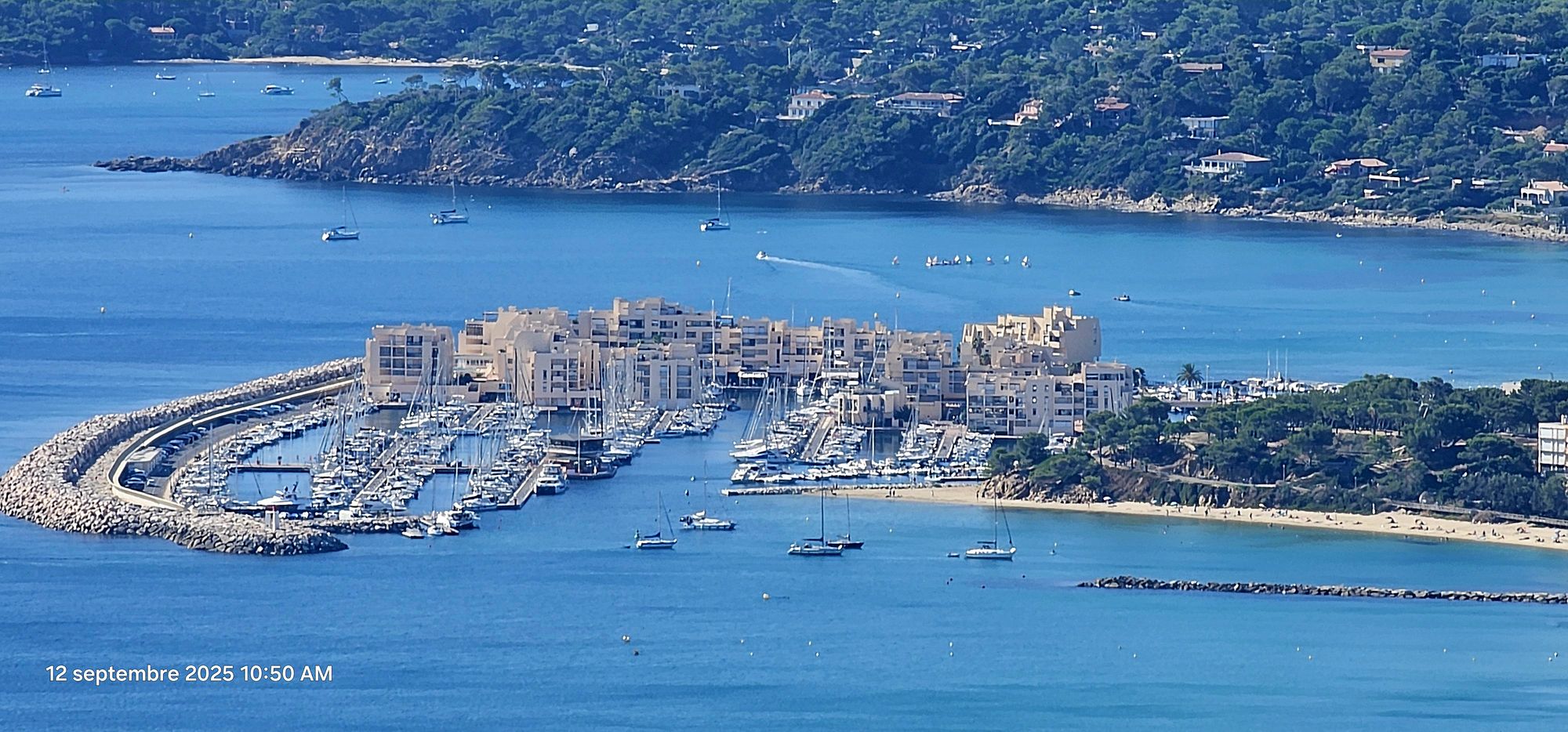
The commune of Le Lavandou stretches 12 km along the Var coast of the French Riviera in the south of France, with 12 sandy beaches and small coves, surrounded by pine trees, mimosas, eucalyptus, succulents and palm trees. All year round: fishing, boat trips, traditional festivals, diving in exceptional underwater landscapes near the Îles d’Or.
Historically, Le Lavandou was a district of Bormes-les-Mimosas until 1909, when the inhabitants of Le Lavandou demanded their independence. The Council of State then established Le Lavandou as a commune by a law promulgated by the President of the Republic, Raymond Poincaré, on 25 May 1913.
Distinctions: 4 flowers ‘Villes et Villages Fleuris’ (Towns and Villages in Bloom), European Blue Flag, Pelagos Charter, 1st Regional Sea Prize awarded by the South Region.
The Department


The Var is a French department in the Provence-Alpes-Côte d’Azur region, which owes its name to the coastal river that once formed the eastern boundary of the department but no longer flows through it today. It is the only French department to have had four different capitals throughout history: Brignoles, Grasse, Draguignan and finally Toulon. The department’s capital is Toulon, while Draguignan and Brignoles are its sub-prefectures. In 1860, the district of Grasse, then sub-prefecture of Var, was detached to form the new department of Alpes-Maritimes. The inhabitants of Var are called Varois. INSEE and La Poste assign it the code 83.
Geography: Var is part of the Provence-Alpes-Côte d’Azur region. It borders the departments of Bouches-du-Rhône to the west, Vaucluse (over approximately 600 m), Alpes-de-Haute-Provence to the north, Alpes-Maritimes to the east, and is bathed by the Mediterranean Sea to the south.
The Var department covers an area of 6,032 km² with 432 km of coastline (including islands)[2]. 58.3% of the area is wooded, representing 351,706 ha, compared to an average of 39.4% for the Provence-Alpes-Côte d’Azur region[3]. Fourteen per cent of the area, or 83,000 ha, is used for agriculture.
The Var has a varied landscape with limestone terrain across the west of the Toulon-Draguignan axis and crystalline terrain to the east. The main mountain ranges are:
- The Maures range (highest point 776 metres) and the Esterel range (highest point 618 metres), which are crystalline.
- To the west of the department is the Sainte-Baume massif (highest point 1,148 metres).
To the north-east of the department, the Lachens mountain (1,712 metres) is the highest point in the department.
Climate:
During the best period, you will enjoy generous sunshine, pleasant temperatures and inviting sea water for swimming. Whether you are looking for sandy beaches, charming hilltop villages or hiking trails through nature, the Var will satisfy your desire to get away from it all under the Mediterranean sun.
Le Lavandou, Bormes-les-Mimosas: April to November, with the ideal period being May to September. These months offer perfect conditions for swimming and exploring the countryside.
LE LAVANDOU
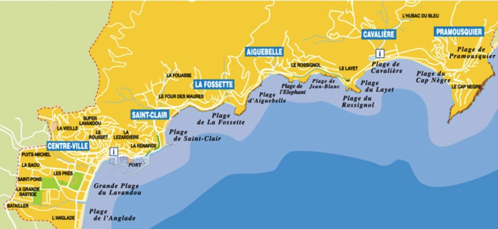
Le Lavandou [lə lavɑ̃du] (in Provençal: Lou Lavandou) is a commune in the Var department, in the Provence-Alpes-Côte d’Azur region, on the Mediterranean coast opposite the Îles d’Or (Île du Levant, Port-Cros and Île de Bagaud) and at the foot of the Massif des Maures. It was created in 1913 when it separated from the commune of Bormes-les-Mimosas, which borders it to the west. Hyères is 22 km to the west and Cavalaire is 20 km to the east by road.
The municipality is located on the Mediterranean coast, 3.9 km from Bormes-les-Mimosas and 18 km from Toulon-Hyères Airport.
Le Lavandou is a former small fishing port that has become a seaside resort on the Var coast.


The must-sees in Le Lavandou
The beaches


Le Lavandou
the resort with 12 sandy beaches
From the Anglade neighbourhood to Pramousquier, 12 different fine sandy beaches await you in Le Lavandou. Under the Var coast’s sunshine, discover hidden coves and steep cliffs, as well as fully equipped beaches. All of them invite you to relax or enjoy water sports and underwater activities.
For more information, click on this Link (In French)
The islands: Levant, Port-Cros and Porquerolles
Discover the Îles d’Or: Île du Levant, Port-Cros and Porquerolles, three sparkling gems off the coast of Var. Port-Cros and Porquerolles are part of France’s 11 national parks. Known as the Port-Cros National Park, these islands belong to the municipality of Hyères.
They are nestled off the coast of Le Lavandou. These Mediterranean paradise islands await you for an unforgettable getaway in Provence.
How to get there, click Here ( In french)
And more ......
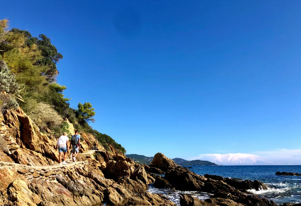
Walking by the sea: Le Lavandou, located in the Var region near Bormes-les-Mimosas, offers a walk by the sea. This is the Lavandou coastal path, a short, unique walk for the whole family. It invites you to discover exceptional landscapes on this hike by the water’s edge. Sometimes also called the customs officers’ path, it is a walk to be discovered without delay!
The coastal path starting from Le Lavandou is a 3 km walk along the seafront.
More information on this Link (In French)